
I really rate this ski tour. In fact, I would have to say its one of the best that I have ever done (!). I know, I know, that is a big call after 35 years of ski touring. But in its category, it is just superb.
Of course it must be compared with similar tours, Apples with Apples… We cannot be compare it to a multi day trip such as the Symphony on skis. And its not like touring based out of a hut such as on the upper Tasman Glacier , or Fox neve. Obviously it cant be compared to extreme descents; there is nothing on this route over 45 degrees and you don’t have to huck yourself off any cliffs. Nor is it the same as climbing a peak to ski down it; this tour is a route rather than a destination. And of course nothing will ever compare to the elation one gets got from skiing their first big mountain. I remember the absolute high of skiing Mt Blanc at 21 years old. Those were special experiences.
Nor is it comparable to long traverses of British Colombian ice caps, Norwegian high plateaus, or the deep powder of Hokkaido. So we must compare ‘pears with pears’ . On the other hand, I do think it is somewhat comparable to some of the high routes around Chamonix, maybe a couple of hundred years ago when there was complete wilderness, sans other people.
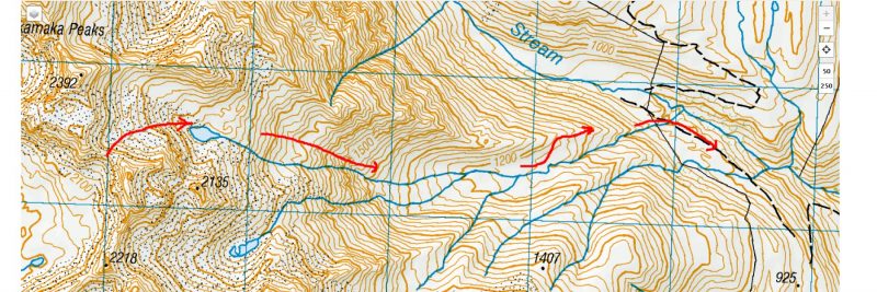
So what is this route? Well its a series of 5, steep powder ski runs, linked by 3 direct, interesting uphill skins, and with a little boot packing thrown in for spice. The skiing is fall line, and I would call the descents skiers/boarders lines, for the skier/boarder connoisseur. The route is a showcase of some of the best terrain of the superb Ben Ohau range, (only leaving out the Twin Stream area).
To describe the route it is easiest if we break it down into 5 parts. I have spent a few years doing reconnaissance trips in this area thinking about how to put this trip together. I had done sections of the route before, but there was still plenty of unknown. And so for me each of the 5 legs held a little trepidation on how things would work out. When ski touring I’m always looking ahead, thinking about how the next section will go, picking up signs and info from the mountains, looking for ‘red flags’ telling me to stop, or for lines of retreat should we become cornered. And so this is this is how the ski tour unfolded in my mind.
Firstly though, note this route should be done in winter with powder snow which has settled to reasonably low levels. A preceding SE storm without wind is ideal of course. The skiing here is on south to east faces and should be descended in powder. In late season the south faces would be firm, icy and scary. The uphill sections are on north faces, open to solar radiation and would be more reactive in the longer warmer days of spring. Having said that, the route holds snow really well and is possible to ski this ski tour right throughout the season. The exit slopes down to the road are usually still ski-able into October.
Good snow stability is required. To check out the avalanche forecast on the day we did this trip, to give you an idea of what snow-pack we were managing , go on to avalanche.net.nz , go to the OHAU region, and at the bottom of the page change the date to 12/8/22.
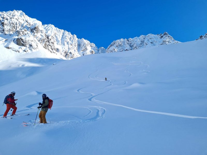
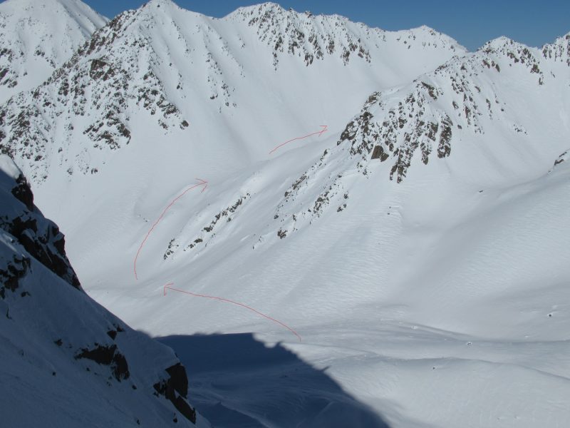
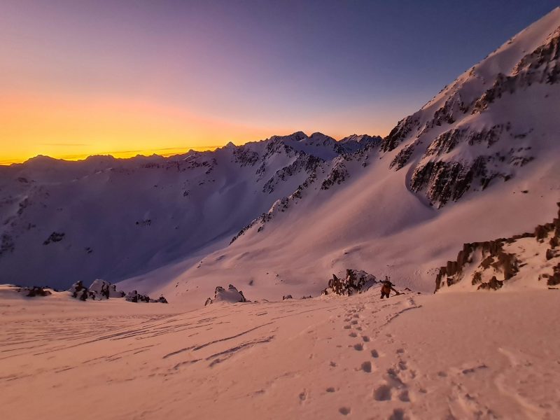
So lets break the trip down to 5 parts: first part WHALE STREAM.
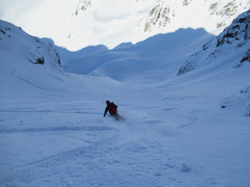
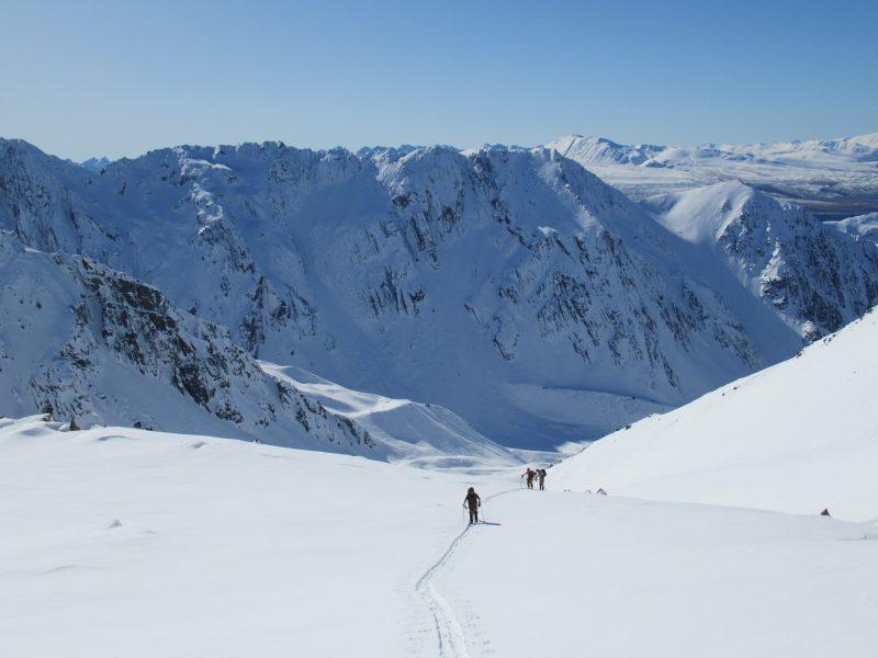
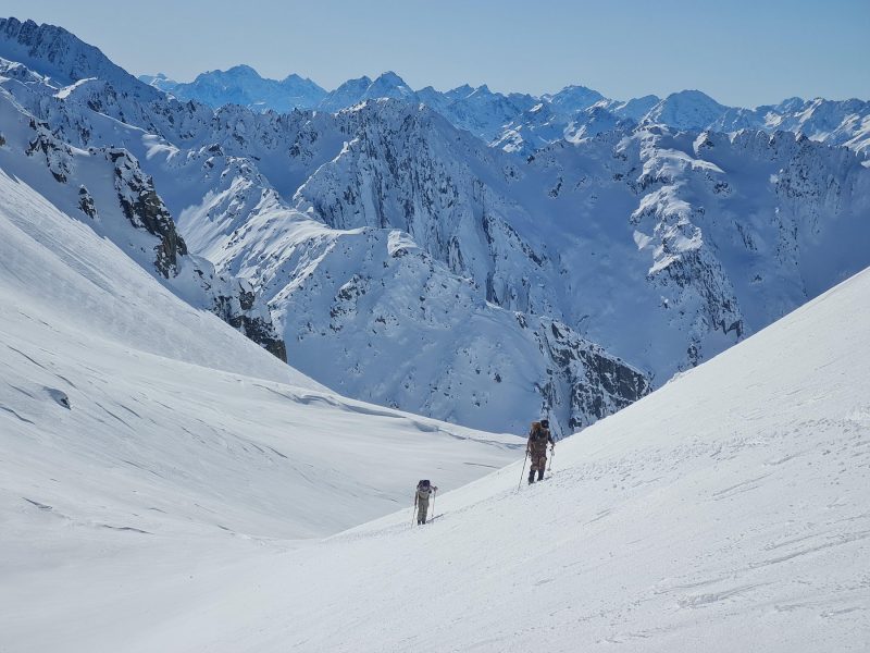
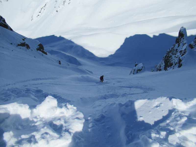
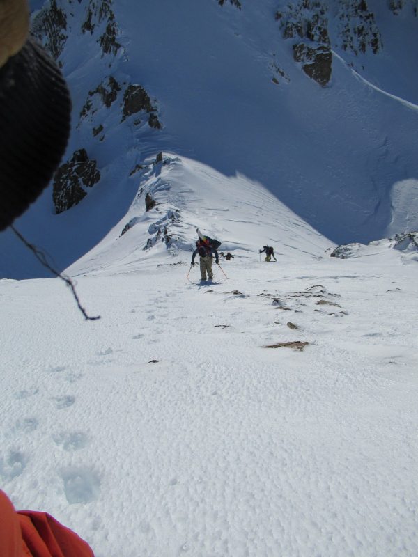
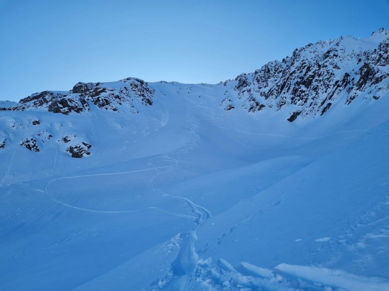
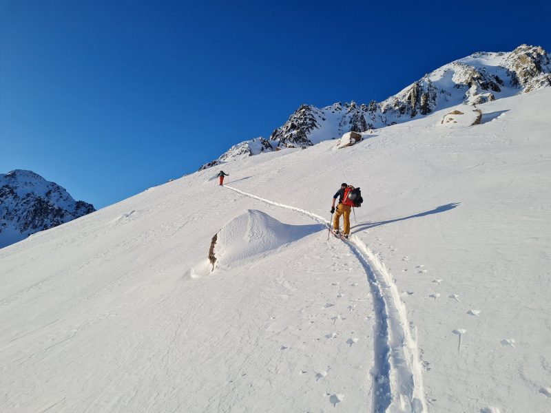
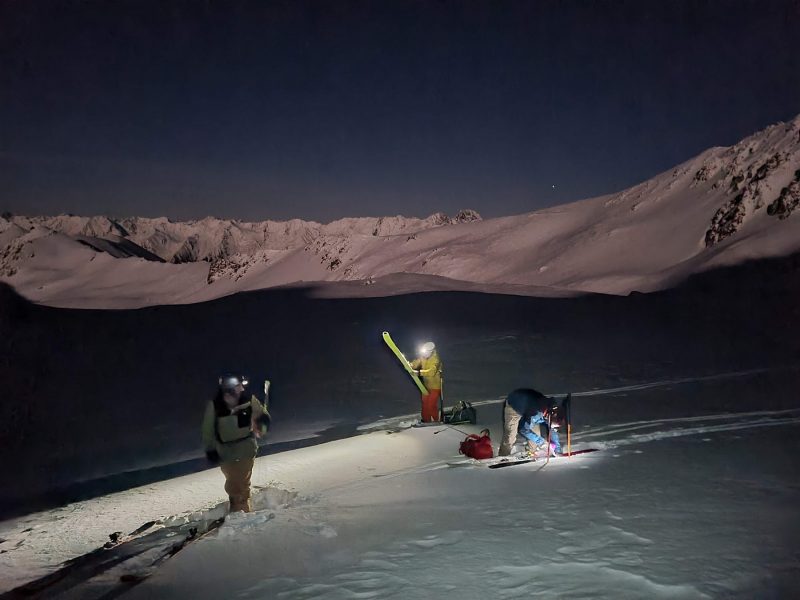
Access is from Glentanner with The Helicopter Line. You can fit 5 people with gear in the heli and the flight is $725 in total. At 145$ each that’s cheaper than a lift ticket. Flying in sure makes things easier, but it also means that a) you don’t really know the snow conditions until you land, and b) you are then committed in any case. The first part of the tour is to ski down between the North branch of Whale Stream and the south branch. There is an interconnecting couloir which has a dog leg bend at he top. Problem number one, could we ski this couloir? Would the top be wind stripped of snow and just hard ice?. How would the snow-pack stability be?
I had skied this part of the route before a few years earlier, here is a link to that trip Whale Stream. One of our team members, Allan, had a ski fall off at the top of the run which slid 400m down the slope. Allan waded down 400 vertical metres of powder, on foot to retrieve the ski. So we call this couloir Allan’s Run. Anyhow, having skied Allan’s run before gave me knowledge and confidence, so off we started. Indeed the entrance was crusty but skiable. To get an idea of what was to come around the corner, one of us skied to the bend and kept an eye out. I skied past the corner and crust soon gave way to delicious powder on 40 degree slopes. One at a time at high speed we descended 400m to a safe spot, regrouped, then relished more powder turns to stop down at about 1380m. Phew, stage one complete.
To note, it was possible to refill water-bottles at about 1300m where Whale Stream (South) was open. There was mobile phone coverage in Nth Branch Whale stream and down into the South branch. There is another option to skiing Allan’s Run, which would be to ski down the North branch of Whale Stream, keeping high to the TR, then cutting back at the confluence with the South Branch of Whale Stream. It would also be a nice ski and an extra 300m of vertical, both down and up (!)
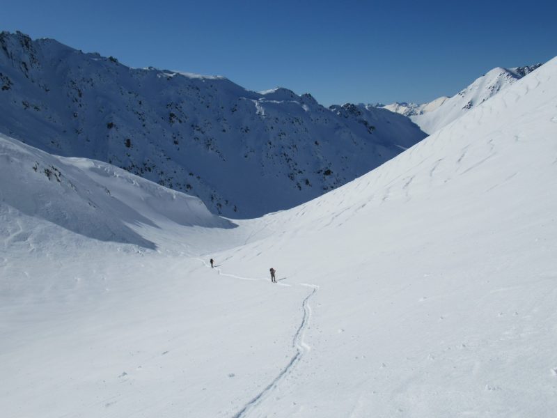
SECOND PART: Up and over from South branch Whale and into Jacks Stream.
Ski touring takes up so much time. The Helicopter Line does drop offs at 9am at the earliest. Taking photos, getting gear organised, testing snow etc. all takes time, and time flies.
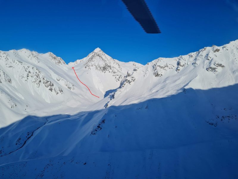
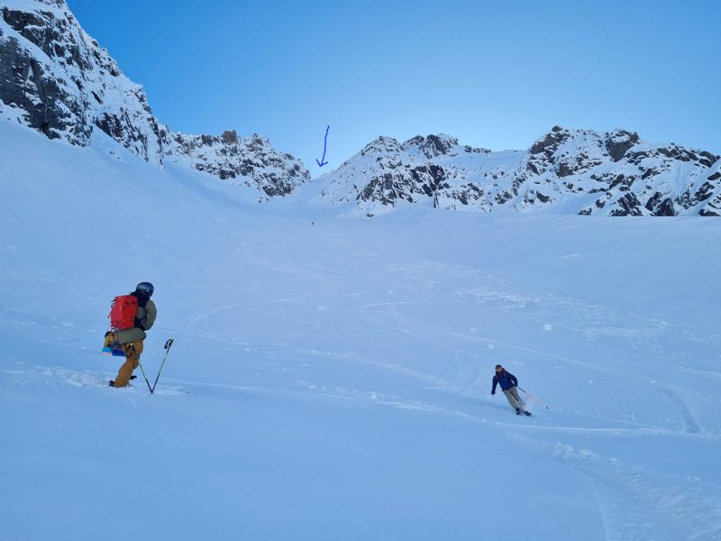
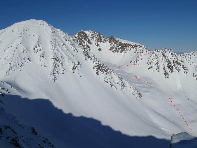
I was keen to get up the next valley before the sun loosened the solar north facing slopes above. In the mountain invariably there is usually a safe route that can be negotiated, less exposed, maybe lower angle, one which is more in the shade etc. In this case there is a small central rib in the valley. We zig zagged our way up this rib, up, up and more up.. It was still reasonably early in the day which was good, but the clock was ticking. So without stopping we skinned up the valley which soon eased back in angle so we could stop zig zagging and ascend directly.
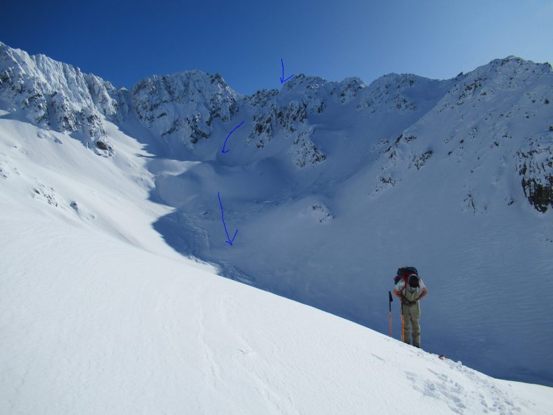
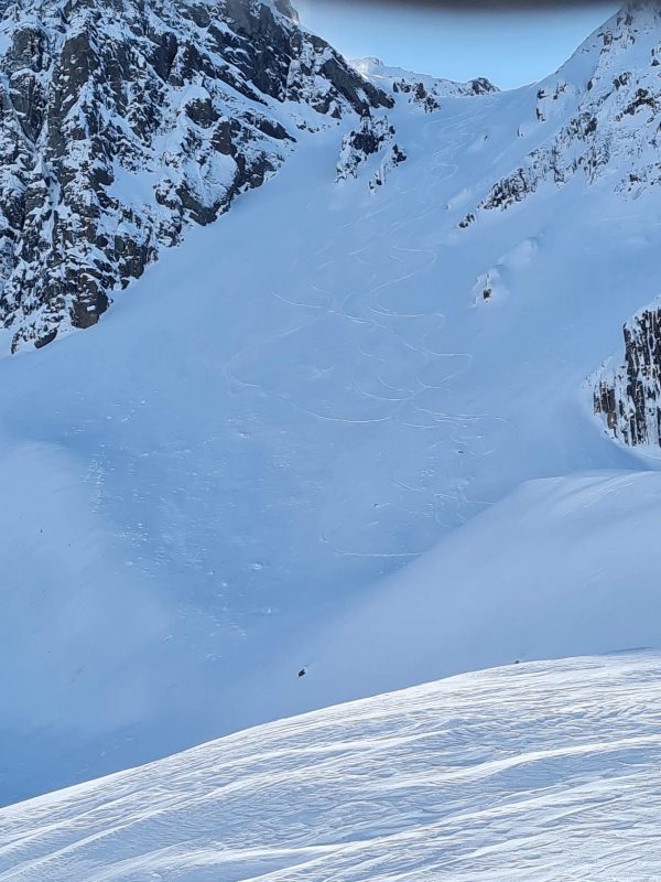
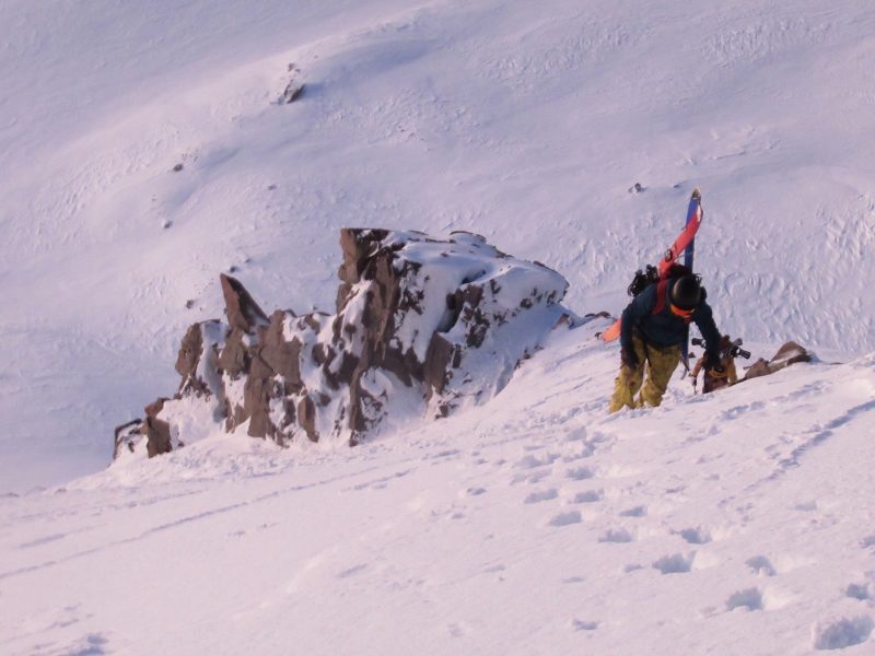
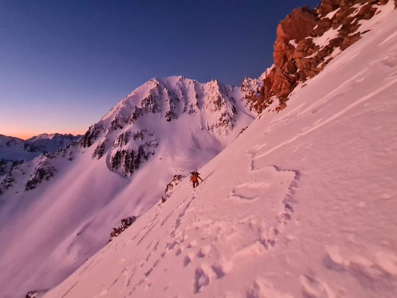
600 m of uphill and over an hour and a half later and we approached the col to the east of Dun Fiunary. This part I hadn’t really seen before and so I was really unsure about what we would find. Would the other side be wind scoured and icy?. Would we have to down climb with ice axe and crampons? Once we go a look around and down the other side it was clear that we had some wonderful power skiing ahead, starting at about 45 degrees. But the route was corniced so it was hard to get an idea of how to enter the face safely, as the stability of the cornice was in doubt.
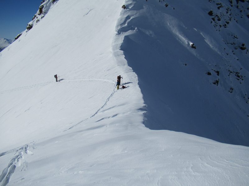
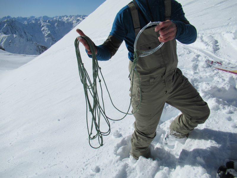
One of the team pulled out a cornice remover (?!). Yep, I had never seen one either. Its a 4 metre cord with overhand knots in it. We cut 2 notches in the cornice with our skis, then looped the rope through and 2 of us sawed through the overhang. We then finished what was left of the cornice off with a shovel, and were left with a nice smooth entry point.
Fantastic high speed skiing of another 400m and we were down into Jacks stream. The snow was a little wind affected here, and we bumped way down to the next transition. Stage 2 over. At this point we no longer had mobile phone coverage. An inReach is not a bad idea as it would be easy to call up the heli to get out. Another arduous option could be to descend Jacks stream.
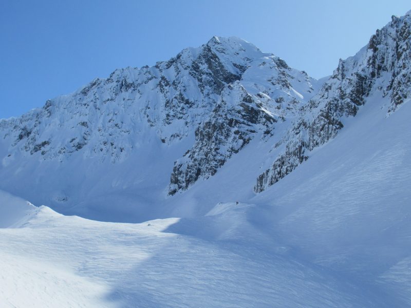
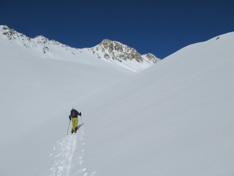
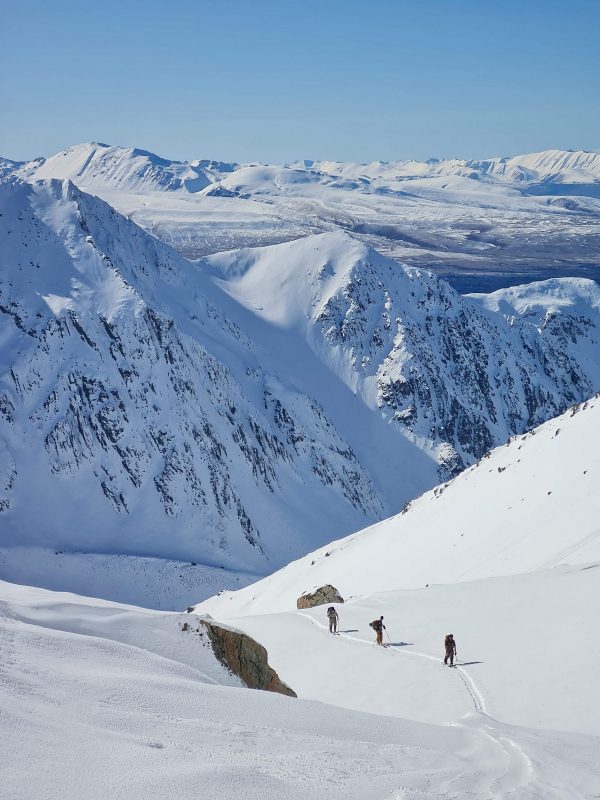
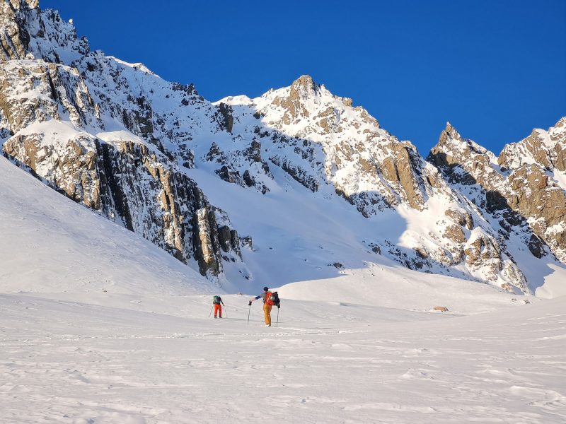
PART THREE: Up the valley to Pk 2206, then into East Branch Stony Stream.
This was completely unknown terrain for us. I had skied Jacks Stream before which is reasonably flat (link to post on Jacks Stream here). And I had had a look at Pk 2206 from the east, but that was it.
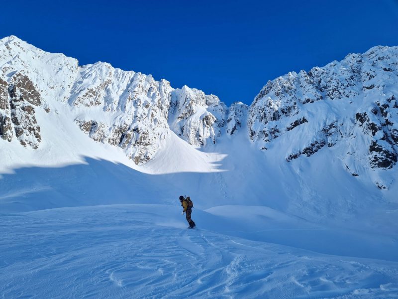
We headed south from Jacks Stream ascending directly up towards pk 2206. Skinning up the valley is straight forward but once again the clock was ticking, and it was after 1pm. Time to get up to the upper, cooler slopes and avoid the solar warming down low.
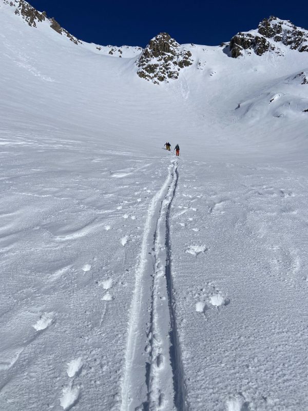
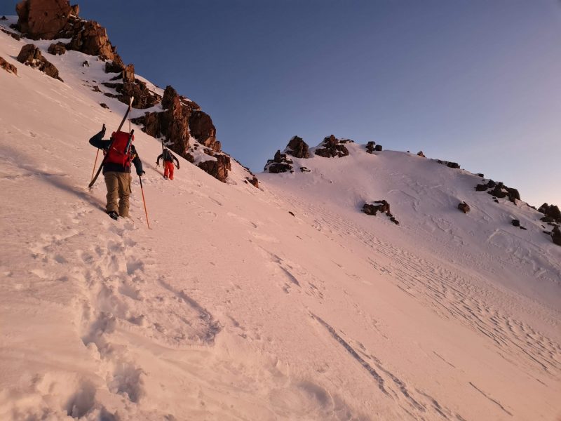
The lower valley also has a safe path with a rib in the middle. Further up it steepens to pass a rocky outcrop. The rocks shade the snow somewhat which helps with the snow pack warming, and by keeping close to the rock we were able to keep out of the wet slide fall line from the ridge above. 500 vertical metres up from the valley and we were on the col at the head of the valley. It was 3.30pm. A quick bite to eat and then decide on the next bit. From here there are 2 routes. One would be to descend through the col to the south, then up over the ridge just to the north of pk 2107, then ski in to Stony Ck East branch. The other route, which we opted to do was boot pack up the 80 vertical metres and over pk 2206.
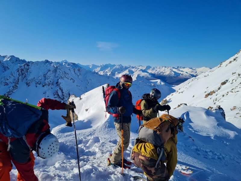
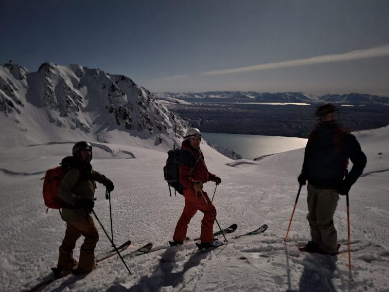
Skis strapped on packs, crampons strapped on boots, we hauled ourselves and gear for half an hour until we were on top of pk 2206. We took a short break on the summit, and absorbed the view.
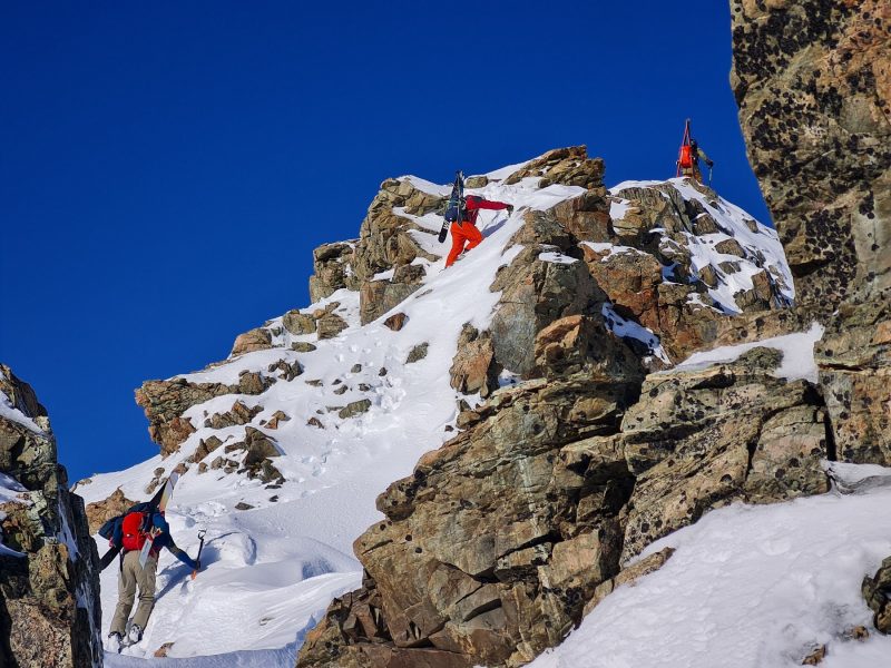
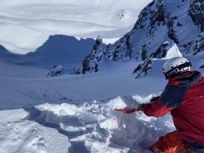
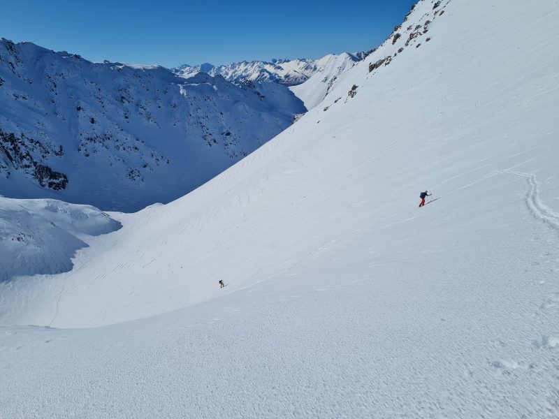
It is quite steep down the other side into Stony Ck. It is also committing because as soon as we started skiing down into Stony Stream there would be no coming back in Jacks Stream. The only way out would be to complete the planned route, or head down Stony Stream (arduous) and into the Dobson Valley. That would be epic (long!).
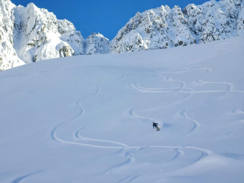
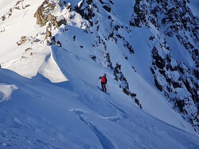
One at a time we skied/rode down from the summit. The snow was a bit ‘grabby’ and it took a few turns to figure out the line. Nice fall line skiing for 500m and we were in the depth of Stony Basin. By this time it was 5pm, and the shadows were lengthening.
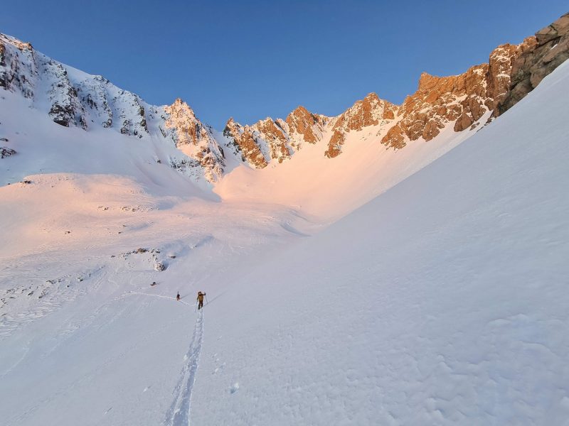
PART FOUR – Climb out of Stony Stream & onto saddle just south of Kaimakamaka (Knuckle) peaks.
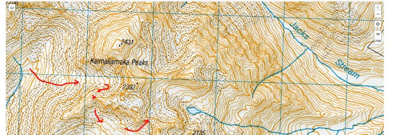
This was the crux, and I always thought it might be. I had been to the Kaimakamaka peaks before, (here is a link to that trip) and I had looked at the route getting out of Stony Stream and onto the flat plateau or saddle just south of pk 2392. I knew that the route would go, but at he same time it wasn’t obvious and so there was plenty of unknown.
So the plan on this trip was to ascend 500m right up the centre of the valley to the headwall of the circque under pk2392, then traverse to the south to gain height and bootpack up to the ridge.
In the last rays of sunlight we found ourselves on the ridge, but stuck. The ridge was a coxcomb of rocky outcrops, or ‘gendarmes‘ which would be difficult and dangerous to climb around and negotiate in the dark with skis and boards on our backs.
At this point I did stop to think that we were fully committed . That is, no heli pick ups and no other reasonable route out. The temperature had plummeted to around -10 so my gloves were freezing solid. We had touring gear and were traveling light, therefore a night out would never be considered. Not that we were considering such. We were still going strong, though getting a little weary.
So we elected to ski over the col and into Irishman Stream. One of us had gotten a glimpse over the other side of the ridge in the last of the light, and thought that it was good to ski. But as I floated down it, by headlamp, fluffy, slow turns in deep champagne powder, I couldn’t help thinking that I hope the slope doesn’t end in a cliff!. I’m not sure if I would have seen one before I floated off it. I felt my way down that slope with the tips of my skis. It was a surreal experience.
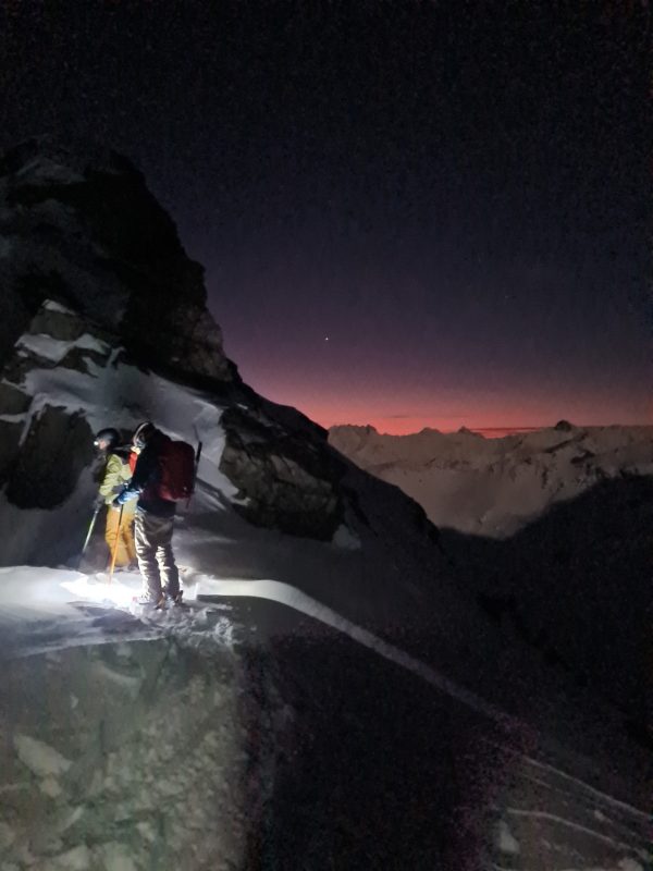
We traversed the head of Irishman’s Stream, got our bearings via GPS, then headed up to the col at 2120m by headlamp. I had been over this col before and new it to be viable, but in the dark it looked like a huge steep frozen wave. It took us a while too as we were tired at this stage.
Part 5. DESCENT TO ROAD.
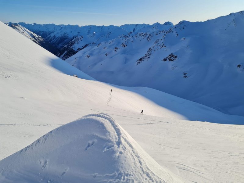
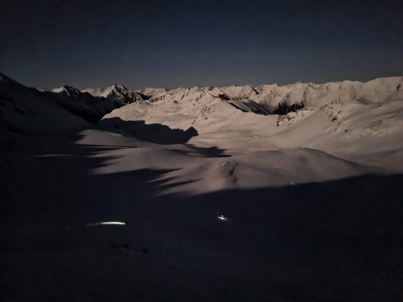
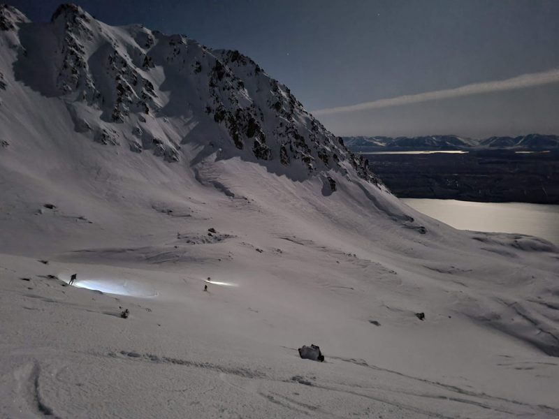
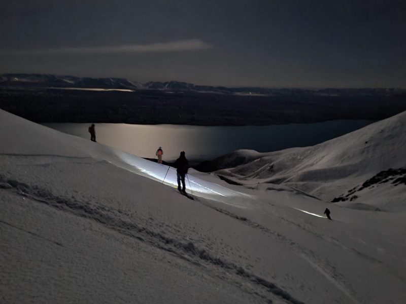
Skiing down is the fun part and most often no bother at all. But there was one niggling doubt I had, and that was running out of snow. We set off from the col in a radiant moonlight, so bright that we could take photos.
The snow was excellent as we made our way down basin after basin, looping big turns, feeling our way here and there. I kept expecting to bump into an unseen wind-lip or hole, but all was silky smooth. Slowly we started to approach the crux. The basin we were in steepens at about the 1700m mark, all the way down to about the 1400m elevation. My concern was that being on a steep slope the snow would get too thin down lower. The line we were on was shady and SE facing, so we might end up on an icy bed surface, ie dust on crust. In the dark that could be difficult. But the lower we went the better the snow got. Eventually we found ourselves in a wonderful steep, powder filled gully that went on longer than our legs could handle. We opened up GS turns, and still the slope seemed endless. An 1100m run in the moonlight. Outstanding!
The snowline is always low in this basin. It faces east, and to the north side there is a ridge that shades the slope and holds snow well into spring time. Down at about the 1000m mark tend to the TL to gain the ridge; it has animal tracks on it and makes for easy walking down to the farm track, which is where we changed into running shoes.
We started our day with a heli landing at 9.30am. We arrived at the car at 11.30pm. A 14 hour day. Our pace was steady but not fast. I’m sure a fitter party could shave a good 3-4, or even 5 hours off our time. A good strong level of skiing is required. We were a mixed team of snowboarders (split boards) and skiers.
Recommended equipment; ice axe and crampons. Trail shoes.
Another thing, we had a full moon which helped on the descent. If you don’t have the luxury of moonlight, an option could be to make it a 2 day trip. Day1, Land Nth branch of Whale Stream, camp, ski tour around the area. Day 2. Pack up early and leave the gear for a helicopter to pick up, and start the ski tour at the crack of dawn. That would provide enough daylight.
I hope that this post did not sound overly epic or difficult, as the route is not so. It is a wonderful ski journey that I recommend to all those who are up to it.
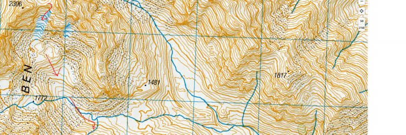
Ben Ohau Haute Route
You must be logged in to post a comment.