Ski Touring New Zealand

Inspiration for winter...

Region: 1 day tour

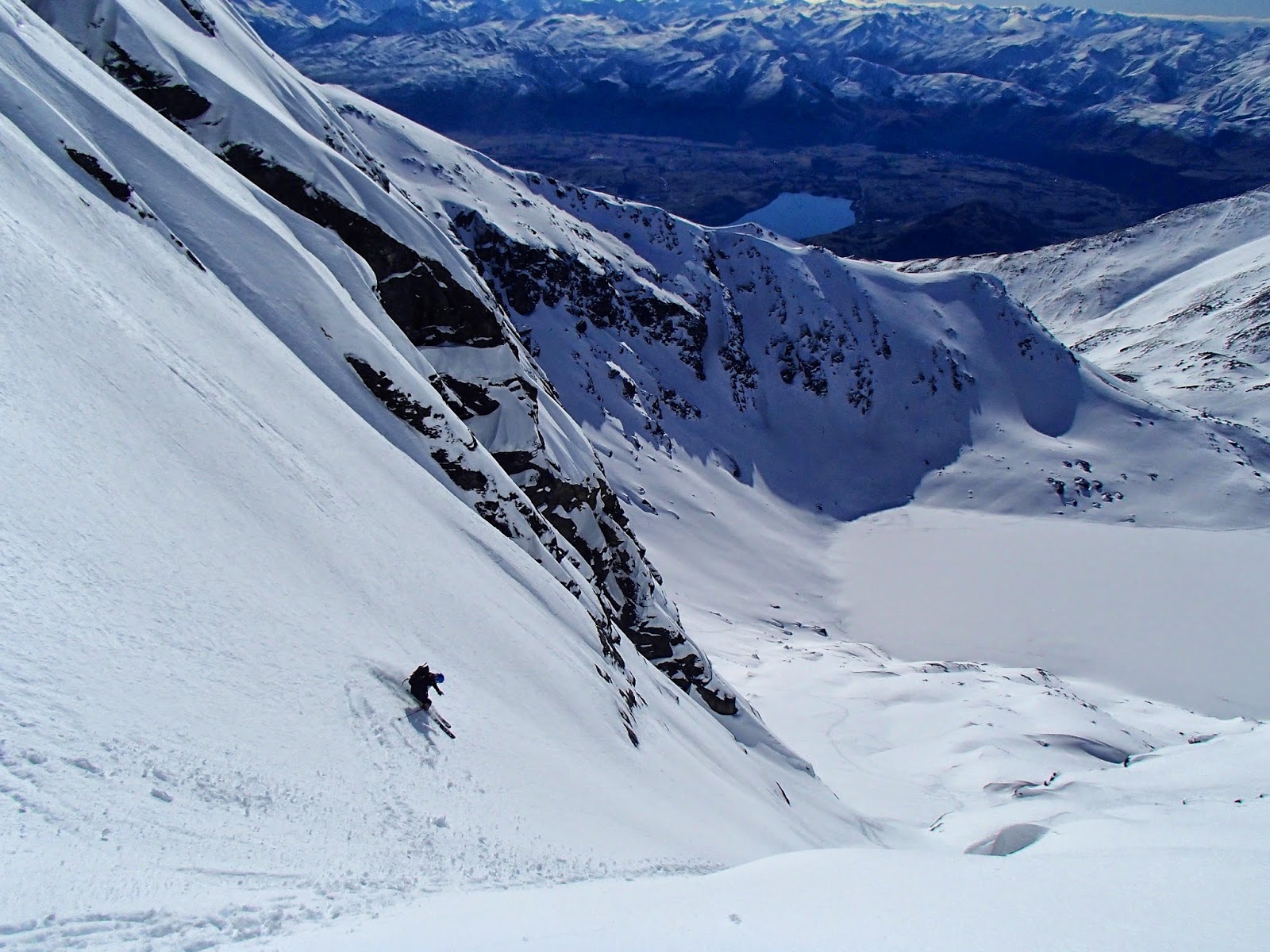
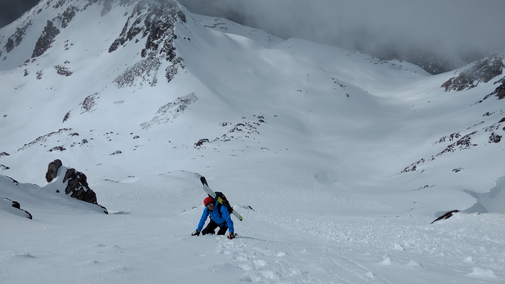
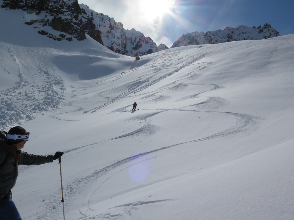
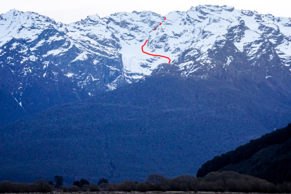
Remarkables; The Grand Couloir, Queenstown

The Grand couloir is an obvious ski line leading from close to the summit of the Remarkables, down to Lake Alta. It is a reasonably popular descent, the skiing is fall line and aesthetic. At the steepest it might be a touch over 40 degrees, but the majority is in

Read More »

Mt Philistine, Arthurs Pass National Park

by Dan & Zucco Arthur’s Pass National Park (APNP) provides a lot of steep or long access routes to the mountains, making it more of a mountaineering destination. However, quality ski touring can still be found. SH73 passes through APNP at around 800 meters and provides some of the better

Read More »

Mt Bonpland, Humboldt Mountains, Glenorchy

By Joel O’Rourke – Bon-what? Yeah, I said the same thing. A quick google search reveals it’s a mountain near the Routeburn Track behind Glenorchy. There is a small glacier (Bryant Glacier) that hangs above the valley and two couloir, one to the north and one to the south of

Read More »

Camp Stream from Roundhill ski field -Two Thumb Range

Once or twice a winter, a strong Easterly or South Easterly front pushes snow into the McKenzie Basin. Snow falls to low levels, often affecting SH8, and leaves Mt Cook Village and Tekapo township with 20cm of snow on the ground. When this event happens it is time to head

Read More »

Mt Ferguson, Richardson Mountains, Glenorchy…

This route is on private land so seek permission from the Scott family at Rees Valley Station (03 442 9908) and please treat the land with respect. The Ferguson basin and valley is also used for heli skiing, during which time access may not be granted. View Larger Topographic Map

Read More »

Mt Wakefield, Kirikirikatata/Mt Cook Range

Situated at the corner of the Tasman and Hooker valleys, Mt. Wakefield is visible from almost anywhere in the valley. After a good southerly dump, it can provide some pretty nice skiing, given the snow line is low – around the 700m mark or below. View Larger Topographic Map Just

Read More »